Somerset Council

LCT 11: Peat and Clay Moors
Location of LCT 11: Peat and Clay Moors - View map full screen
Location and Summary
The Peat and Clay Moors LCT is located in the centre of Somerset, broadly extending east and south-east from Bridgwater to Martock, with another part of the LCT extending east from parts of the Levels (LCT 10) near East Huntspill towards Glastonbury. The LCT is divided into two parts by the rising Polden Hills (within LCT 12: Limestone Lowland Hills) and is partially contained by other areas of the Limestone Lowland Hills (LCT 12), with a strong relationship between these contrasting landscapes. The LCT extends east from the Levels (LCT 10), which forms a similar low-lying landscape, though with a distinct field pattern and greater influence of settlement. More broadly, the low-lying Peat and Clay Moors LCT is contained by the Mendip Hills, to the north and north-east, and the foothills of the Quantock Hills to the west and north-west.
The Peat and Clay Moors LCT forms a low-lying wetland landscape, strongly influenced by a linear field pattern created by the rhynes and ditches which drain the landscape, and areas of underlying peat which have influenced the landcover. The LCT primarily comprises areas of pastoral floodplain grazing marsh, with an open character and broad horizons. A relatively strong rural character and sense of tranquillity is experienced within the LCT.
Landscape Character Areas
The Peat and Clay Moors LCT is divided into two landscape character areas (LCAs):
- LCA11a: located in the north of the LCT and extending between the Levels (LCT 10) near East Huntspill and Glastonbury, with a stronger relationship to the Mendip Hills to the north.
- LCA11b: located in the south of the LCT and extending between Bridgwater to Langport, partially contained by the foothills of the Quantock Hills to the west and north-west, with a more gradual transition between this LCA and surrounding valley landscapes.
Differences or specific characteristics that are more relevant to one of the LCAs above are noted in the profile below.
Landscape Description
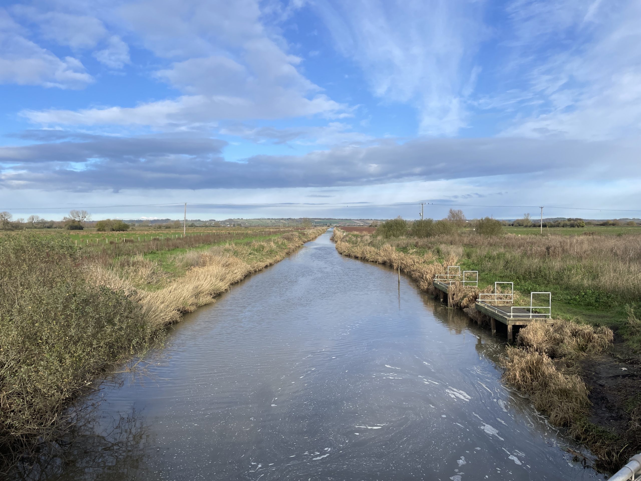
A low-lying landscape drained by channelled rivers and linear rhynes
Key Characteristics
- Extensive areas of peaty soils, with some clay floodplain soils overlying areas of mudstone and interbedded mudstone/limestone, resulting in a flat, open and low-lying floodplain landscape with broad horizons.
- Drainage of the land, from the 18th century onwards, has strongly influenced the rectilinear pattern of drainage channels and drove roads, which form field boundaries.
- Ditches, rhynes, rivers and ponds contribute to wetland character with a strong relationship to water, and support an extensive and unique habitat for birds, invertebrates, amphibians and wetland mammals.
- Predominantly pastoral land use contributes to the floodplain grazing marsh character, with some areas of former peat extraction and cultivation of traditional crops contrasting with the predominant simple and uniform pattern.
- An open landscape characterised by low-growing vegetation, with trees and wet woodland focused within fen habitats associated with areas of former peat extraction and traditional orchards associated with farmsteads and villages.
- Gentle ridgelines form ‘islands’, with settlement focused on these localised areas of slightly higher ground or strongly related to the linear network of minor roads.
- Areas of peat result in well-preserved archaeological remains, including a concentration of prehistoric timber trackways (designated as Scheduled Monuments), mainly surviving as underground features, but with an above-ground replicated section of track at Shapwick Heath. Earthworks associated with prehistoric duck decoy ponds (designated as Scheduled Monuments) further indicate previous uses of the wetlands through centuries.
- High levels of rural tranquillity and an experience of dark night skies, away from settlements located beyond the edges of the LCT. The limited network of public rights of way contributes to the sense of remoteness, contrasting with the access infrastructure and facilities provided at promoted nature reserves.
- A dynamic influence of water which lends to a changing sense of place and local distinctiveness in an otherwise simple and open landscape.
Natural Influences
The Peat and Clay Moors LCT forms a low-lying, flat and open landscape which contrasts with the more elevated landscapes of escarpments, plateau and hills which partially surround the LCT. The landform of the Peat and Clay Moors LCT generally sits below 10 metres Above Ordnance Datum (AOD) and is slightly lower in elevation than the Levels (LCT 10), which extends to the west and north-west of the Peat and Clay Moors. Limestone Lowland Hills (LCT 12) rise from the Peat and Clay Moors, forming distinctive skyline features with a contrasting landscape and settlement pattern. More broadly, the Mendip Hills and Quantock Hills form a distant background and offer containment to the open landscape of the Peat and Clay Moors. A more gradual transition along the edges of the Peat and Clay Moors exists in eastern parts of LCA11a and the southern and eastern parts of LCA11b, where the simple and low-lying landform of the Peat and Clay Moors changes to the gently undulating valleys of the Tributary Valley Farmland (LCT 26) and the Farmed and Settled Low Vale (LCT 22).
Peaty soils overlie predominantly mudstone, with some interbedded limestone or halite-stone of the Jurassic and Triassic periods (Mercia Mudstone, Langport Member, Blue Lias Formation and Charmouth Mudstone Formation). Some areas of alluvial and marine clays are located along the western edge of the LCT, at its transition to the Levels (LCT 10), occasionally forming shallow ridgelines or ‘islands’ in the otherwise flat and low-lying landscape.
Hydrology has strongly influenced the land use and landscape pattern of the LCT. Drainage and reclamation of the Peat and Clay Moors started later than the adjoining Levels (LCT 10), with the Peat and Clay Moors forming an unmodified wetland landscape of marshes and fenlands until drainage and enclosure started in the 18th century. A linear network of ditches, rhynes and canalised rivers crosses the LCT. The tidal range of the Bristol Channel is the second highest in the world, and the low-lying Peat and Clay Moors are prone to periodic flooding. Much of the LCT is located within Flood Zone 2 and 3, although this is controlled by a sophisticated management network including man-made defences, embanked rivers, spillways, sluice gates and pumping stations. Water-filled pits or ponds associated with areas of former peat extraction are managed as nature reserves with regenerated wet woodlands, reed beds and aquatic habitats, notably near Shapwick Heath, Meare Heath and Walton Heath.
The presence of water within the LCT gives rise to a variety of unique habitats, with widespread areas of coastal and floodplain grazing marsh, raised bog, lowland fens and lowland meadows (all priority habitats) supporting a variety of birds, invertebrates, amphibians and wetland mammals. These habitats form part of the Somerset Wetlands National Nature Reserve (NNR), England’s second ‘super’ NNR which absorbed six separate reserves spread across the landscapes of the coastline, levels and moors. Numerous Sites of Special Scientific Interest (SSSI) are located across wetland habitats of the Peat and Clay Moors, and also form the Somerset Levels and Moors Important Bird Area (IBA).
Vegetation within the LCT mainly comprises low-growing species associated with unimproved grasslands, wet meadows, fen, mire and reedbeds with occasional hedgerows or pollarded willows lining rivers and rhynes. Carr woodland (wet woodland) around fen habitats at Shapwick Heath in the north of the LCT (LCA11a) have a mixed vegetation pattern of tussock sedge and sphagnum moss, bog myrtle, alder, willow, birch, pine and oak. Small pockets of woodland and some small areas of traditional orchards (priority habitat) are also associated with farmsteads and the edges of villages and hamlets. The density of woodland in these areas contrasts with the more open landscape pattern of other parts of the LCT.
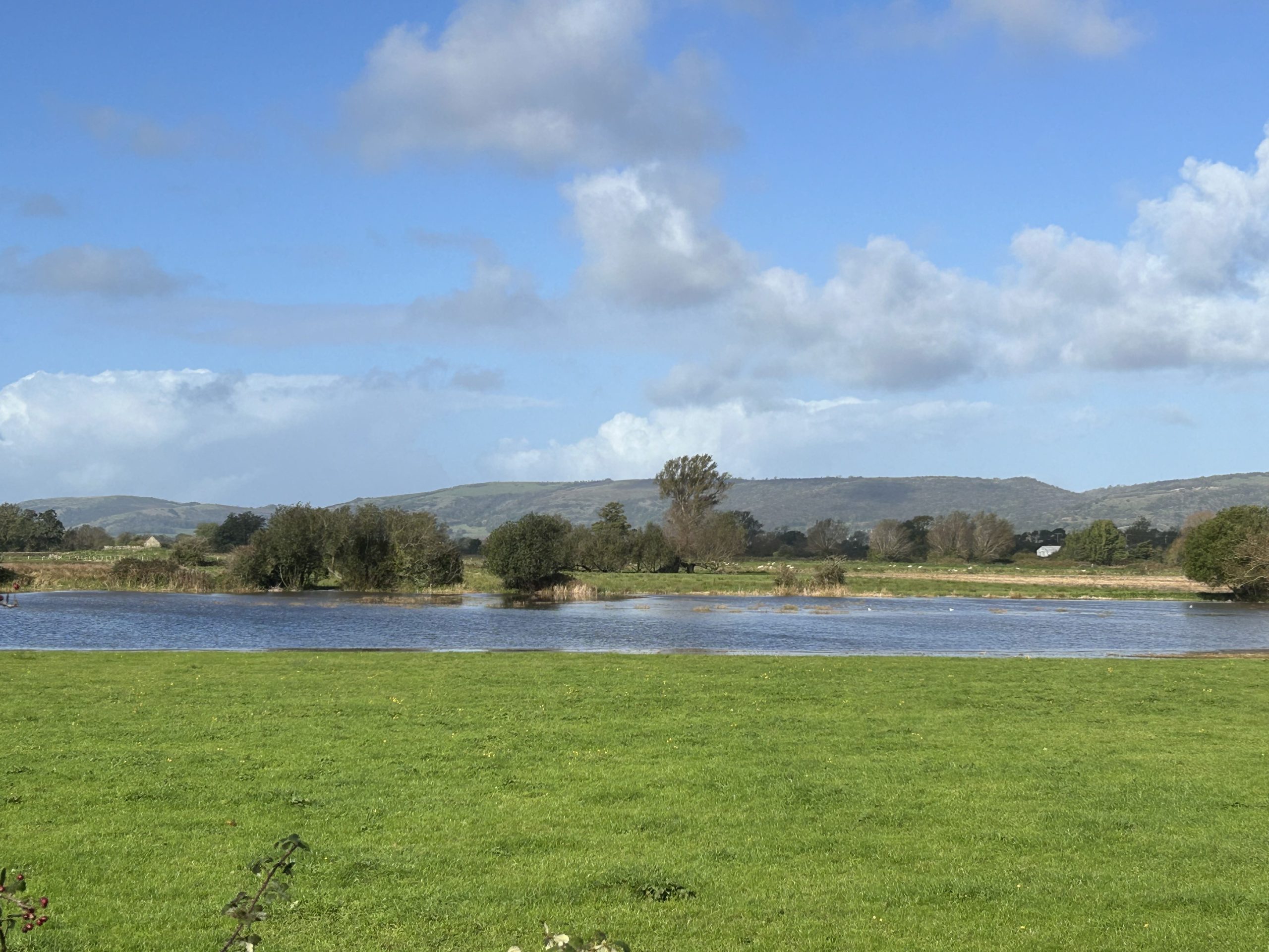
Seasonal inundation of the Peat and Clay Moors, looking towards the Mendip Hills
Cultural Influences
The reclamation and modification of the landscape of the Peat and Clay Moors primarily dates to the 18th century. The surviving field pattern strongly reflects the original process of drainage and enclosure through the network of rhynes and ditches which form ‘wet fence’ field boundaries. This linear pattern is also reflected in the network of short and straight lanes or drove roads which cross the LCT. Settlement within the Peat and Clay Moors is limited to small farmsteads and hamlets, the pattern of which is strongly related to the linear network of minor roads. Larger villages, such as Meare in the north (LCA 11a) and Westonzoyland, Middlezoy and Othery in the south (LCA 11b) are focused on the shallow ridgeline ‘islands’ within the moors. Typical building materials include brick and clay tile, as well as local lias limestone from the nearby hills. Main roads, including the A372, A361 and A39, generally connect settlements within the LCT to other larger settlements located on higher ground outside of the LCT. The M5 passes along the south-western boundary of the LCT (LCA11b) near Bridgwater. Overhead lines crossing the LCT and railway lines in the south of the LCT (LCA11b) form a more contemporary linear influence, with pylons forming noticeable skyline features crossing the low-lying landscape. Pumping stations form a localised modern influence, typically located along main rivers including the River Brue and Huntspill River. Solar farms are located throughout the LCT, though the scale and arrangement of arrays generally reflects the underlying field pattern. Cheddar Reservoir forms an evident man-made feature in the north of the LCT (LCA11a) and is encircled by embankments which rise from the surrounding lower-lying landscape.
Pastoral grazing or production of silage are the dominant land uses, which contributes to the character of the floodplain grazing marsh. Smaller areas of arable production are focused where soils are better drained, including around the edges of the LCT and along the shallow ridgeline ‘islands’ near Westonzoyland in the south of the LCT (LCA11b), and are related to areas of Agricultural Land Classification (ALC) Grade 1 land. Withy, or willow for basket making, was once a predominant crop in the area due to the wet conditions, however the extent of withy beds within the LCT is now much more limited. The colour and texture of withy beds, concentrated near Lyng in the south of LCT (LCA11b), contrasts with the surrounding pastoral fields.
Before the Peat and Clay Moors were drained and modified, human use of the wetlands was focused on fishing and hunting for waterfowl. Remains of prehistoric timber trackways (designated as Scheduled Monuments) which facilitated access into and across the wetlands between higher areas of dry ground activities are located throughout the LCT, though particularly focused in the north (LCA11a). These survive as buried remains and notably include the Sweet Track, which is the second-oldest timber trackway discovered in the UK. Sections of the Sweet Track have been recreated above ground at the Shapwick Heath National Nature Reserve. Earthworks associated with duck decoy ponds (also designated as Scheduled Monuments) are present in the north of the LCT (LCA 11a) near Weston Heath and Glastonbury Heath and the south of the LCT (LCA 11b) near Butleigh Moor.
The Battle of Sedgemoor took place in the north-west of LCA11a near Westonzoyland, (now designated as a Registered Battlefield), across the landscape of open pastoral moors which remain the predominant character today. The battle was part of the Monmouth Rebellion in 1685, in which the Protestant Duke of Monmouth attempted to overthrow the Catholic King James II.
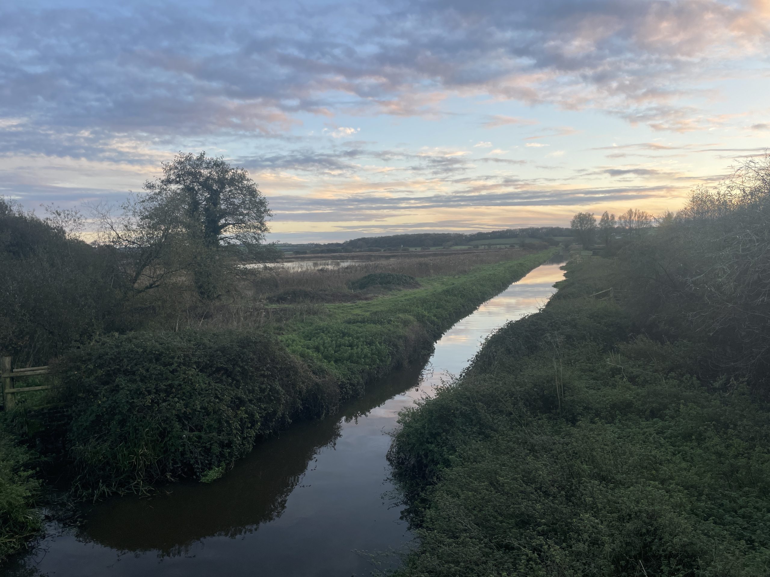
Linear pattern of rhynes reflects the historic drainage of the land
Perceptual Influences
Relatively high levels of tranquillity and dark night skies are experienced across the LCT, with some adverse influence of light pollution in the north-east of the LCT (LCA11a) associated with Glastonbury (located in the adjoining LCT 12: Limestone Lowland Hills), and the south-west of the LCT (LCA11b) associated with Westonzoyland and Bridgwater. A sense of remoteness and tranquillity is particularly strong within the interior of the moors in the north of the LCT (LCA11a). However, the popularity of promoted visitor facilities at the numerous nature reserves within the LCT brings noise and movement into these parts of the landscape, contrasting with the sense of remoteness felt in other less accessible parts of the LCT.
The gentle and low-lying landform and limited tree cover within the LCT allows for open and distant views with broad horizons to be experienced across the LCT. More distant views to the north-east and west to south-west are focused on the skylines formed by the Mendip Hills and Quantock Hills. The Mendip Hills National Landscape is located within close proximity to the northern boundary of LCA11a. The relationship of the Peat and Clay Moors to the Mendip Hills contributes to the “distinctive limestone ridges and scarp slopes, rising from the Somerset Levels and Moors” and views towards and outward from the Mendip Hills, which are special qualities of the National Landscape. The LCT also has a strong visual relationship with the Lowland Limestone Hills (LCT 12) which rise from the Peat and Clay Moors, including near the Isle of Wedmore, Pennard Ridgeline, Polden Hills and High Ham ridgeline. Views are more contained where mature hedgerows and wet woodland is present, though these are limited.
Overhead lines with pylons form prominent vertical skyline features contrasting with the predominantly horizontal character of the broad skylines experienced within this low-lying landscape. The Hinkley Point C connection crosses the south-west of the LCT (LCA 11b) and is the first overhead line to use new T-pylons. These T-pylons are visually distinctive from other older steel lattice pylons which cross the LCT. Solar farms, mainly focused around edges of the south of the LCT (LCA11b), exert an adverse influence on the rural character of views, though the scale and arrangement of arrays generally reflects the underlying field pattern. Pumping stations along main rivers also exert an adverse influence on the rural character of views. The Westonzoyland airfield conflicts with the scale and pattern of the surrounding rural landscape. Commercial and industrial units located along the southern edge of Bridgwater (in LCT 10: Levels) form a localised influence on views experienced from the south of the LCT (LCA 11b), with the M5 also forming a visual and audible influence on this part of the LCT.
Extensive areas of bird habitat support a notable population and diversity of bird species, which contributes visually and audibly to parts of the LCT. The presence of water and seasonal changes in flow patterns contributes to a changing and dynamic landscape. The network of public rights of way (PRoWs) within the LCT is limited and is mainly focused around areas of higher ground near key villages or follows the linear network of drove roads. The River Parrett long-distance footpath and NCN Route 339 crosses the south of the LCT (LCA11b), following the course of the River Parrett between Stathe and Bridgwater. Part of NCN Route 3 crosses the north of the LCT (LCA11a), following the road network to the north and west of Glastonbury. Another short section of NCN Route 3 passes through the south-west of the LCT (LCA11b), following the Bridgwater and Taunton Canal. Other formal recreational opportunities to experience the landscape are mainly focused in the north of the LCT (LCA11a) near the nature reserves at Shapwick Heath, which provide visitor facilities and recreational opportunities within an otherwise relatively inaccessible landscape.
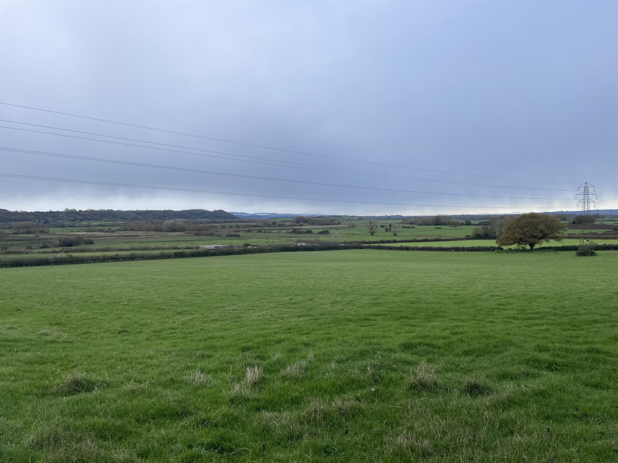
Expansive views across the low-lying rural landscape, with occasional influence of overhead lines
Landscape Evaluation
Key Sensitivities and Valued Features
- Peaty soils within this LCT and the Levels (LCT 10) form the second largest area of lowland peat in the UK, contributing to biodiversity, carbon storage and preservation of archaeological remains.
- The historic field pattern of small to medium scale pastoral fields defined by a linear pattern of drainage ditches, rhynes and drove roads contributes to the prevailing character of the floodplain grazing marsh, sense of place and time depth.
- Traditional withy beds reflect the historical use of the land, contributing to time depth, sense of place, and adding a contrasting texture into the landscape.
- Well-preserved underground archaeological remains replicated above-ground at Shapwick Heath, and earthworks associated with former uses of the land add to the sense of place, time depth and recreational value.
- Fen habitats and areas of wet woodland provide unique habitats and contribute to sense of place.
- Areas of traditional orchards contribute to traditional rural character, provide habitat connectivity and form recognisable markers of settlement edges in the open landscape.
- Open and expansive views, including a strong visual relationship to the skylines formed by the Mendip Hills and Limestone Lowland Hills (LCT 12) contribute to sense of place.
- Areas of rural tranquillity and a sense of remoteness which contributes to the setting to the Mendip Hills National Landscape.
- The influence of water within ditches, rhynes, rivers and ponds which provides habitat connectivity and contributes to sense of place.
- Promoted visitor facilities within nature reserves provide valued recreational opportunities.
The Changing Landscape
The following section sets out the changes and pressures to the Peat and Clay Moors LCT.
- Ongoing decline of traditional orchards in favour of more intensive agricultural production has resulted in a change of character to settlement edges, more open views and less contrast in landscape pattern and texture within the LCT.
- Solar farms have influenced the land cover pattern and form localised modern features in the rural landscape. Increased pressure for renewables may continue to result in expansion of solar farms and associated electrical linear infrastructure, further changing the character of the rural landscape and loss of historic field pattern.
- The introduction of T-pylons within the LCT form modern vertical features that are more distinctive than older steel lattice pylons.
- Local initiatives, such as the ‘Reimagining the Levels’ group, are increasing woodland and hedgerow coverage within the LCT through tree and shrub planting. This enhances the habitat networks within the LCT, whilst also influencing the vegetation pattern and visual character within localised areas of the LCT.
- Changes in wetland habitats as a result of drought and warmer temperatures may result in changes to the land use or an intensification in grazing, changing the visual character of the LCT and reducing the extent and quality of these unique habitats.
- Changes in sea level as a result of climate change may increase the frequency and severity of regular tidal inundation, changing the composition of wetland habitats, the visual character of the LCT and reducing opportunity for recreational access.
- Increased temperatures as a result of climate change, as well as increased frequency and severity of flood events in winter and drought events in summer may affect the water levels of the rhynes and need for further flood management infrastructure.
- Increased temperatures and frequency of drought events as a result of climate change may result in a drying out of peaty soils, releasing carbon, reducing the vegetation cover and increasing the risk of fire hazards and erosion.
- Altered seasonal rainfall patterns as a result of climate change may result in changes to the composition of quality of wet woodland and fen habitats.
- Expansion of Cheddar Reservoir to increase the drinking water supply may result in greater modern human influence in the north of the LCT.
- Increased recreational pressure as a result of population increase and settlement expansion may result in erosion of footpaths or walkways and increased traffic congestion near promoted recreational locations, such as nature reserves.
Landscape Guidelines
These guidelines recommend how the landscape can be managed to ensure future change respects the local character and should be read in conjunction with the overarching management strategy objectives of the Somerset Landscape Character Assessment.
Landscape Management
- Protect and manage traditional orchards. Where possible, connect and extend small orchards, and involve local communities in management of these spaces. This will change the land use, field pattern and vegetation pattern in some parts of the LCT which form the setting to settlements, enhancing sense of place.
- Manage areas of grazing marsh, wet woodland and fenlands, blocking drains or installing leaky dams where appropriate to retain and slow the flow of water. By keeping land wetter and cooler in summer months, important habitat and characteristic landscape features will be maintained.
- Manage and restore the hydrological function of areas of peat, wet woodland and fenlands, rewetting where appropriate to ensure the carbon storage and habitat opportunities within these areas are enhanced and preserved. This may change the pattern of vegetation in some parts of the LCT.
- Consider increased use of gravity-led drainage systems instead of pumping, enhancing connectivity between rivers and their floodplains. Reduced reliance on pumped drainage would change the character of the landscape locally, offering opportunity to return areas with modern infrastructure to that of a more traditional rural character.
- Maintain and restore the extensive pattern of drainage ditches and rhynes to retain the historic field pattern and areas of valuable aquatic habitat. Consider connectivity of these features with rivers and the wider hydrological network to enhance opportunities for flood management and nutrient filtration.
- Enhance or create areas of woodland sensitively so that the open character of the landscape is retained, engaging with local community initiatives such as Reimagining the Levels. New planting will be required particularly for the stabilisation of riverbanks and to slow the flow of run-off, while bringing improvements to water quality. This may change the visual character of the landscape locally, but will add further contrast to the pattern and texture of the landscape in some parts of the LCT. In some parts of the LCT, locally-appropriate planting will include saline-tolerant tree species.
Development Management
- Avoid prominent development of an overbearing vertical scale which conflicts with the open views available in this low-lying and flat landscape.
- Protect and conserve buried archaeological remains, avoiding degradation of the peat which preserves these remains.
- Ensure new development provides appropriate mitigation for nutrient neutrality, which may include constructed wetlands, changes in land management or retrofitting Sustainable Urban Drainage systems. This may change the visual character or landscape pattern in parts of the LCT.
- Retain the smaller scale and more dispersed pattern of settlement found in the north of the LCT, avoiding coalescence between settlements and retaining the sense of rural tranquillity expressed in the north-east of the LCT.
- Consider cumulative impacts, sensitive siting and design of renewable energy developments and associated electricity infrastructure, particularly to avoid the perception of a ‘wirescape’, or numerous overhead lines of discordant appearance, in parts of the LCT already influenced by this type of infrastructure.
- Conserve the character of the panoramic views across the LCT that are experienced from, and characteristic of, the Mendip Hills National Landscape and Quantock Hills National Landscape.
- Maintain and enhance visitor facilities for recreational users, ensuring buildings and parking areas are sensitively sited and constructed of locally-appropriate materials. Manage recreational access surrounding these areas to avoid erosion or degradation of footpaths and walkways.