Somerset Council

Frome: FR3
Assessment Parcel FR3 - View map full screen
Assessment Parcel Location and Description
The assessment parcel extends along the western perimeter of Frome. Most of the assessment parcel is located within LCT 4: Sandstone Slopes and Valley Heads. Areas to the east of the A362, in the north-east of the assessment parcel, are located within LCT 5: River Valley, however the landscape character of the assessment parcel is more closely aligned with the Sandstone Slopes and Valley Heads LCT. The key sensitivities and valued features of the LCTs that would be sensitive to change as a result of residential and commercial development within the assessment parcel include:
- ‘The alternating patterns of hard limestone and softer sandstone create contrast between incised valleys and high points, which form recognisable features and contribute to the complex topographical pattern.’ (LCT 4)
- ‘Enclosed areas of incised slopes in the north (LCA 5b) contribute to the landscape pattern, character of views and sense of place.’ (LCT 5)
- ‘Areas of riparian woodland contribute to the character of the landscape and provide an important habitat for wildlife’ – concerning the River Frome within the north of this assessment parcel (LCT 5)
- ‘Valued walking routes, such as the East Mendip Way’ – which traverses the centre of this assessment parcel in a rough east-to-west direction from the settlement edge of Frome (LCT 4)
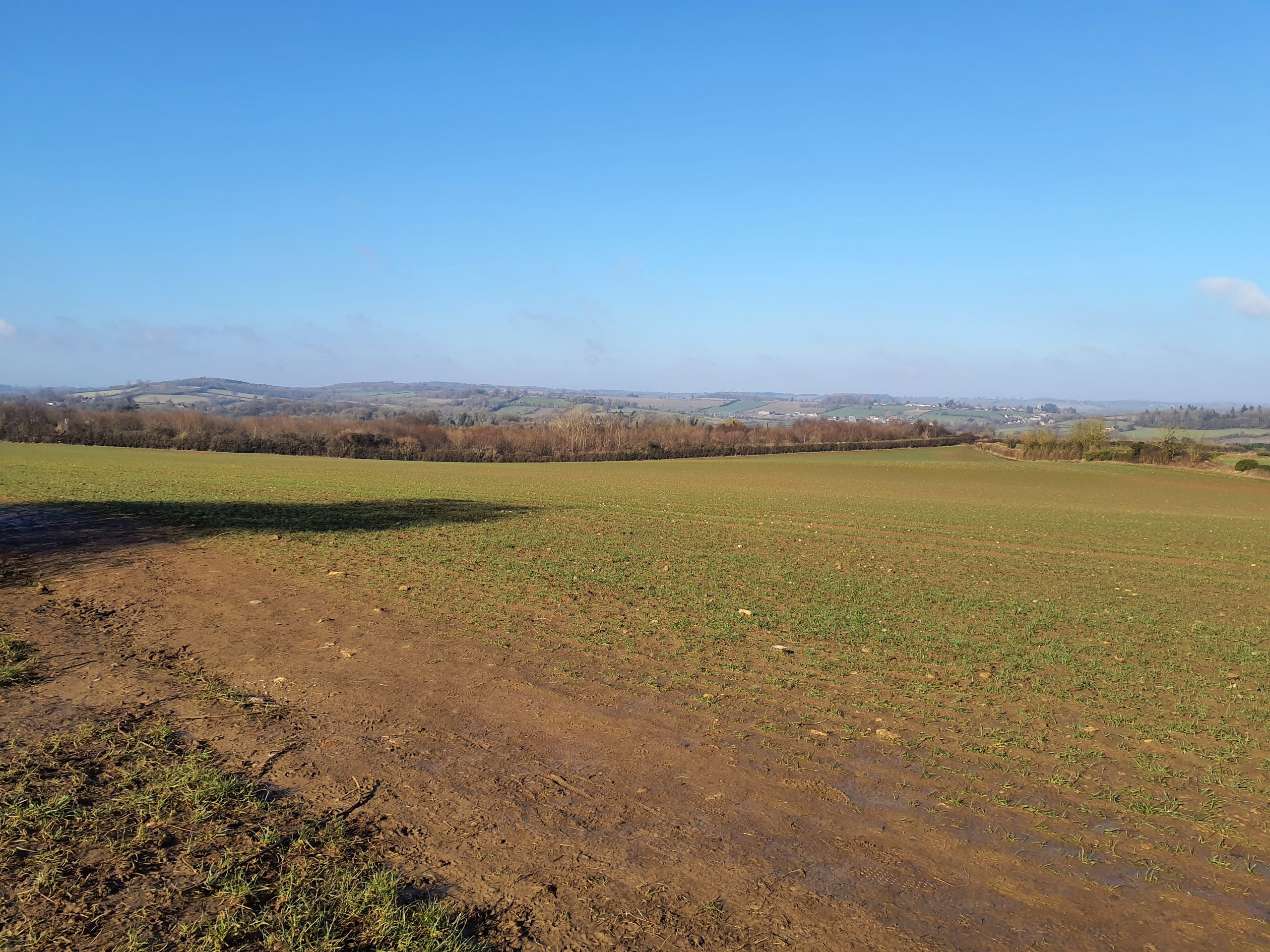
Views north-west from the elevated settlement edge towards rolling areas of landform within the Sandstone Slopes and Valley Heads (LCT 4).
Landscape Sensitivity Assessment
Physical character (landform, scale and field pattern)
- Landform descends from elevated areas (125m AOD) located along the settlement edge and the plateau near Vallis House, towards the River Frome in the north (60m AOD) and the Mells River and its tributaries (beyond the western boundary of the assessment parcel). Most of the assessment parcel consists of steep slopes.
- Fields are mostly medium in scale with a mixture of irregular and regular field patterns bound by hedgerows. Some areas of smaller-scale fields are located across steep slopes adjacent to the settlement edge in the south, and along the River Frome in the north.
- The landscape is more intricate and enclosed within the north of the assessment parcel along the River Frome due to the increased woodland cover. The landscape is more expansive along areas of plateau in the north-west, where field patterns are larger, as well as along the exposed upper slopes in the west.
Residential Score: Moderate-High
Commercial Score: Moderate-High
Natural character
- Landscape is dominated by agricultural use and horse paddocks, resulting in a limited network of semi-natural habitats with no local, national or international designations.
- Deciduous woodland (priority habitat) is focused in the north, and includes sinuous riparian woodland surrounding the River Frome supplemented by pockets of woodland extending up the valley slopes. An area of lowland calcareous grassland (priority habitat) is located adjacent to deciduous woodland (in the north of the assessment parcel) and adds to the natural character.
- Two small, isolated areas of traditional orchard (priority habitat) are located adjacent to the settlement edge in the south.
Residential Score: Low-Moderate
Commercial Score: Low-Moderate
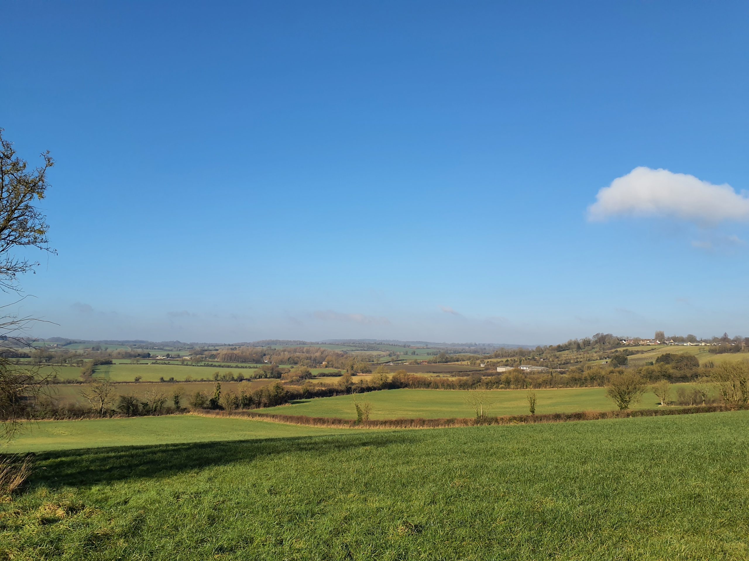
Wider views across the sloping landform from the settlement edge at Marston Gate.
Historic character and time depth
- A landscape without a strong sense of time depth, with limited locally or nationally designated archaeological or heritage features. The exception is Knoll House (Grade II listed building), on the settlement edge within the centre of the assessment parcel.
- Some areas of surviving historic field pattern are located across steep upper slopes. However, an influence of field amalgamation, due to intensification through modern farming practices, is present across the centre of the assessment parcel. Field division by horse paddocks has altered the historic field pattern of fields in the south of the assessment parcel.
Residential Score: Low
Commercial Score: Low
Character and setting of the settlement
- The settlement edge is located along areas of plateau landform, avoiding the steep sloping sections of the assessment parcel to the west and resulting in a strong relationship to the underlying topography.
- The settlement edge is mainly formed of 20th and 21st century residential developments, with a sewage works located along the north-west of the settlement edge. Dense hedgerows help integrate the settlement edge, but where hedgerows are low or absent, the settlement edge is more abrupt. Breaks in hedgerows also allow for glimpsed open views across the attractive rural setting provided by the assessment parcel.
- A sparsely settled area consisting of scattered farmsteads and some peri-urban land use in the south of the assessment parcel. A series of gardens with wooden fences extend from the settlement edge across the descending slopes in the south of the assessment parcel creating a less defined and more exposed settlement edge.
Residential Score: Moderate-High
Commercial Score: Moderate-High
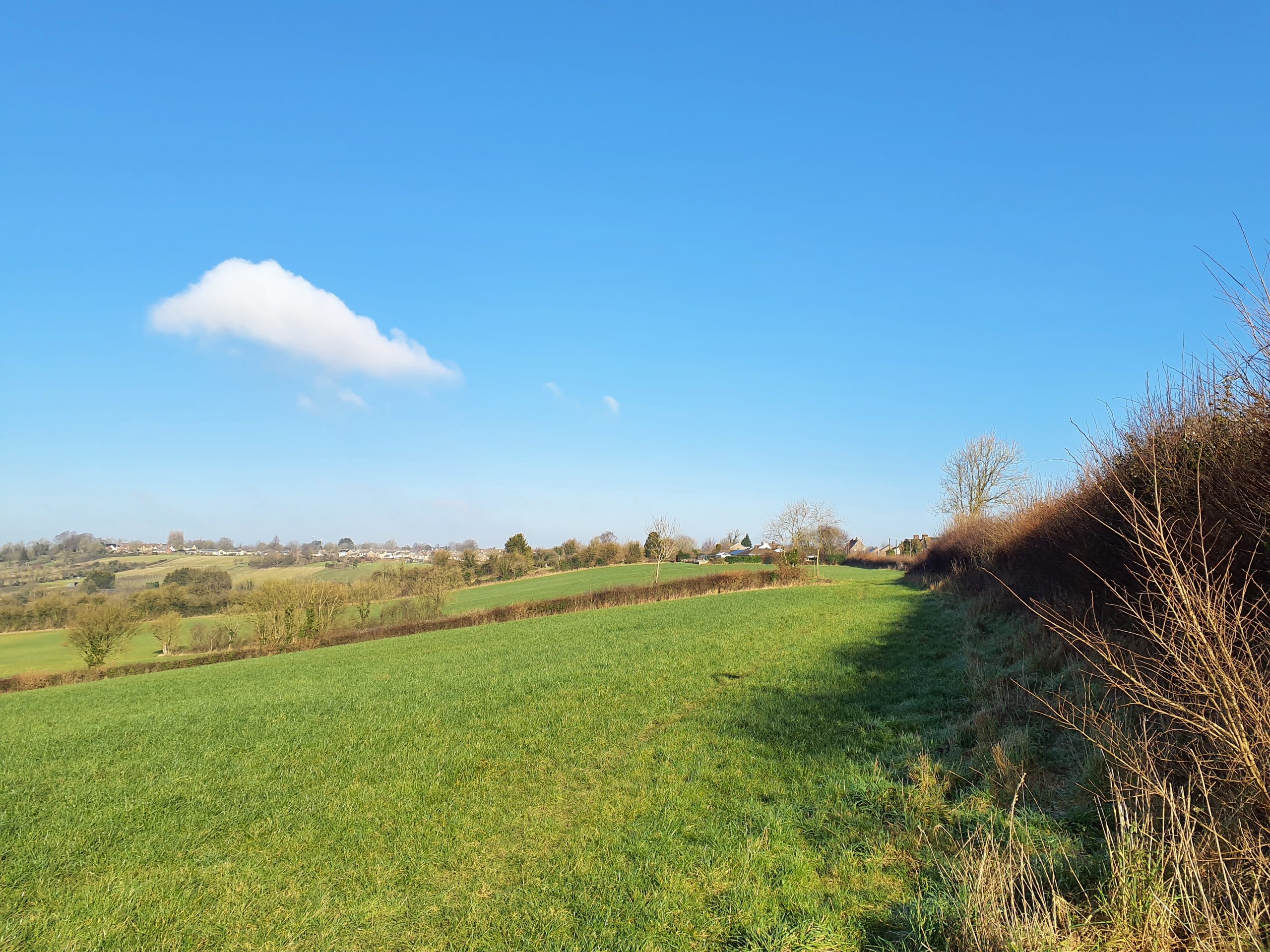
Views north along the settlement edge, which extends across an area of elevated plateau and avoids steep descending slopes.
Visual prominence, skyline and views
- The west-facing slopes of the assessment parcel form a visually prominent escarpment in views from the lower-lying landscape to the west. Whilst the existing settlement edge forms a partially-developed skyline, development is generally set back from the edges of the escarpment.
- Dense hedgerows along the settlement edge generally restrict views into the assessment parcel from the settlement. However, occasional glimpsed and distant views overlooking the assessment parcel, and across the wider landscape are available, particularly from Marston Road on the settlement edge in the south.
- The steep-sloping nature of the landform results in the settlement edge being a visually prominent feature in views eastwards from within and beyond the assessment parcel. A radio mast along the settlement edge at Egford Hill creates the sense of a developed skyline.
Residential Score: Moderate-High
Commercial Score: Moderate-High
Perceptual and scenic qualities (including access and recreation)
- Peri-urban land use in the form of horse paddocks and extensions of back gardens into the south of the assessment parcel detracts from the rural quality of the area.
- The A362 and the B3090 have a localised adverse influence on tranquillity.
- PRoWs are mainly focused in the north of the assessment parcel, and include the East Mendip Way long distance footpath and other interconnected footpaths near the River Frome.
Residential Score: Low
Commercial Score: Low
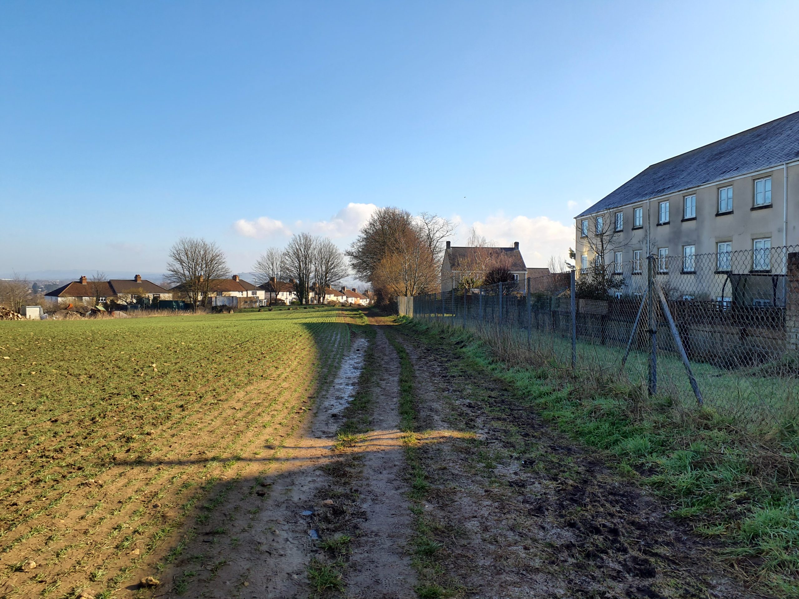
A lack of woodland or landscaping lining the settlement edge creates an abrupt edge.
Sensitivity scores for all indicators
| Indicator | Sensitivity Score - Residential | Sensitivity Score - Commercial |
|---|---|---|
| Physical Character (landform, scale and field pattern) | Moderate-High | Moderate-High |
| Natural character | Low-Moderate | Low-Moderate |
| Historic character and time depth | Low | Low |
| Character and setting of the settlement | Moderate-High | Moderate-High |
| Visual prominence, skyline and views | Moderate-High | Moderate-High |
| Perceptual and scenic qualities (including access and recreation) | Low | Low |
Summary of Overall Landscape Sensitivity
The settlement edge consists of predominantly 20th and 21st century developments located along areas of gentle plateau landform. The assessment parcel contains limited semi-natural habitats and valued natural or historic features, which reduces the sensitivity of the assessment parcel to residential and employment development.
However, the steep sloping landform descends from the settlement edge to low points along the assessment parcel’s boundary, forming an important skyline in views from the wider landscape. The existing settlement pattern is defined by the landform of the assessment parcel, and any further development within the assessment parcel would be at odds with this existing pattern, increasing sensitivity. The steep topography, visual prominence of the assessment parcel and glimpsed views outwards from the settlement edge across the rural landscape of the assessment parcel increase the sensitivity of the parcel to residential and commercial development. This raises the overall sensitivity of the parcel to Moderate-High to residential development and commercial development.
Overall sensitivity scores for residential and commercial development
| Overall Residential Score | Overall Commerical Score |
|---|---|
| Moderate-High | Moderate-High |
Development Management Guidance
To minimise adverse impacts on the landscape and visual character, development proposals should consider the overarching guidance principles for accommodating both residential and employment development in Somerset (see Development Guidance). In addition, development proposals should consider the following location-specific management guidance as set out below:
- Avoid locating development on the steep sloping landform of the assessment parcel, particularly within the west of the assessment parcel, which would increase the intervisibility of the settlement with the surrounding landscape and would be at odds with the existing settlement pattern.
- Consider sensitively sited development within localised areas of lower landscape sensitivity, including small areas of gentler plateau landform along the settlement edge. Development should be set back from the edge of the plateau to avoid development spilling out onto areas of exposed slopes.
- Ensure that any new development would seek to better contain the settlement edge with hedgerows and woodland buffers, particularly to the south of the assessment parcel where wooden garden fences currently create a relatively abrupt settlement edge.
- Make sure that development seeks to maintain the areas of woodland surrounding the River Frome within the north of the assessment parcel.